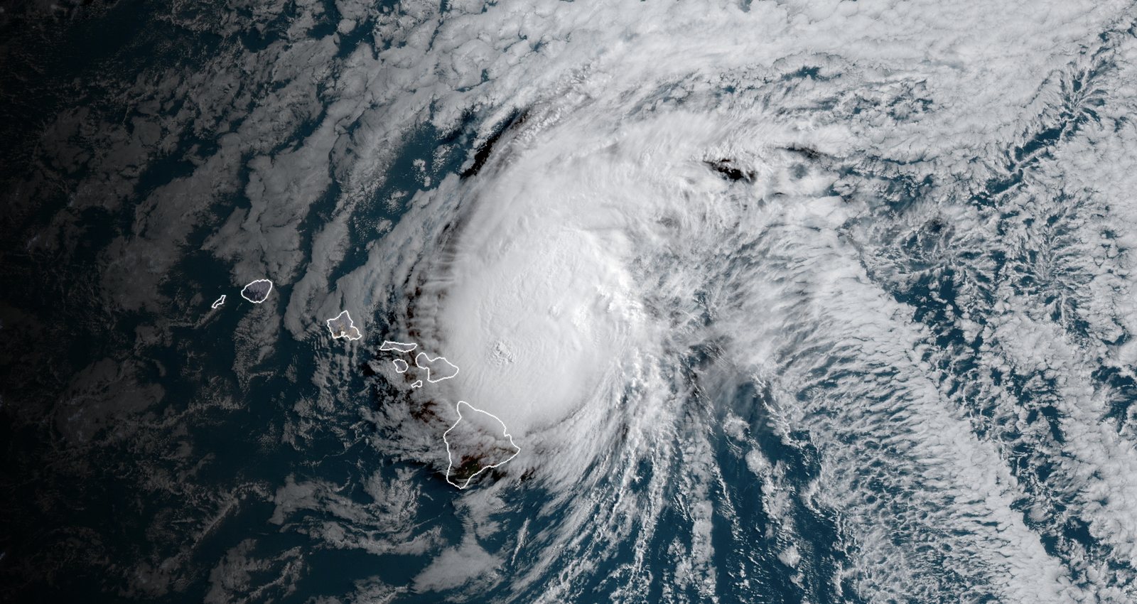
Early Wednesday, Sept. 23, Tropical Depression 15-E was more than 300 miles south-southeast of Hawaii’s Big Island and was forecast to strengthen into Tropical Storm Nolo later Wednesday and into a hurricane by Thursday night, CNN (opens in new tab) reported, citing the National Hurricane Center.
As of Sept. 23, NHC guidance cited by CNN (opens in new tab) called for the system’s closest approach to the Big Island on Saturday night as a potential Category 3 major hurricane, with the center possibly only about 50 miles from the southern shoreline. Tropical storm-force winds above 40 mph were likely and hurricane-force winds above 75 mph were possible on the Big Island’s south side Friday through at least Saturday, CNN (opens in new tab) said.
The Hurricane Center warned that “life-threatening, catastrophic flooding and mudslides are possible” again on portions of the Big Island and Maui. Rainfall forecasts at the time included 10 to 15 inches over the Big Island through Sunday with up to 35 inches in the steepest terrain, and 5 to 10 inches on Maui with isolated amounts up to 20 inches, according to CNN (opens in new tab)’s NHC summary. Dangerous seas were expected to peak Friday and Saturday.
CNN (opens in new tab) said Hawaii alone has already faced three tropical systems in less than a month earlier in the season’s count, and that a third hurricane coming within 100 miles of the main islands in one season would be the first such occurrence since at least the 1950s if the forecast verified. Prior close approaches included Hurricane Lala (Category 1, mid-August) and Hurricane Lowell (Category 2, early September).
Forecasters and CNN (opens in new tab) attribute the hyperactive eastern and central Pacific season—18 named storms including three Category 5s at the time—to a very strong El Niño layered on already warmer oceans. CNN (opens in new tab) reported at the time that tropical alerts for parts of Hawaii could be issued later Wednesday.
Update, Oct. 1: Nolo, formerly a hurricane, drenched parts of the Big Island over the weekend and is now a tropical storm threatening dangerous conditions for parts of the Papahanaumokuakea Marine National Monument, the Associated Press reported. As of 5 a.m. HST Thursday, the Central Pacific Hurricane Center placed Nolo about 390 miles west of Lihue with maximum sustained winds near 60 mph, moving west-northwest near 5 mph. A tropical storm warning is in effect for the monument from Nihoa to Maro Reef, including near French Frigate Shoals, and a tropical storm watch from west of Maro Reef to Lisianski Island. The center forecasts a westward turn with a large increase in forward speed by the weekend and says Nolo could become a hurricane by then; its forecast discussion says the storm could be close to a major hurricane again by the time it nears the Dateline in three to four days. Hawaii News Now (opens in new tab) reported that Nolo will gradually accelerate westward away from the state, while moisture keeps a wetter pattern mainly over Kauai and Oahu through the end of the week. CNN (opens in new tab) reported Oct. 1 that the eastern and central Pacific season has produced 20 named storms, including three Category 5 hurricanes, and that Lala, Lowell and Nolo all swiped the island chain with heavy rain and strong winds.